


Kenego Voting District, Choctaw County, Mississippi
About
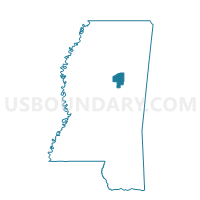
Outline

Summary
| Unique Area Identifier | 605187 |
| Name | Kenego Voting District |
| County | Choctaw County |
| State | Mississippi |
| Area (square miles) | 55.56 |
| Land Area (square miles) | 55.36 |
| Water Area (square miles) | 0.20 |
| % of Land Area | 99.63 |
| % of Water Area | 0.37 |
| Latitude of the Internal Point | 33.40461630 |
| Longtitude of the Internal Point | -89.38055980 |
Maps


Graphs
Select a template below for downloading or customizing gragh for Kenego Voting District, Choctaw County, Mississippi


Neighbors
Neighoring Voting District (by Name) Neighboring Voting District on the Map
- Byway Voting District, Choctaw County, MS
- Chester Voting District, Choctaw County, MS
- French Camp Voting District, Choctaw County, MS
- Hebron Voting District, Choctaw County, MS
- Nations Voting District, Montgomery County, MS
- Stewart Voting District, Montgomery County, MS
- West Weir Voting District, Choctaw County, MS
Top 10 Neighboring County Subdivision (by Population) Neighboring County Subdivision on the Map
- District 4, Montgomery County, MS (2,131)
- District 2, Choctaw County, MS (1,825)
- District 1, Choctaw County, MS (1,628)
- District 3, Choctaw County, MS (1,579)
Top 10 Neighboring Unified School District (by Population) Neighboring Unified School District on the Map
Top 10 Neighboring State Legislative District Lower Chamber (by Population) Neighboring State Legislative District Lower Chamber on the Map
Top 10 Neighboring State Legislative District Upper Chamber (by Population) Neighboring State Legislative District Upper Chamber on the Map
Top 10 Neighboring 111th Congressional District (by Population) Neighboring 111th Congressional District on the Map
Top 10 Neighboring Census Tract (by Population) Neighboring Census Tract on the Map
- Census Tract 9502, Choctaw County, MS (4,201)
- Census Tract 9501, Choctaw County, MS (2,761)
- Census Tract 9502, Montgomery County, MS (2,677)
Top 10 Neighboring 5-Digit ZIP Code Tabulation Area (by Population) Neighboring 5-Digit ZIP Code Tabulation Area on the Map
- 39744, MS (6,008)
- 39735, MS (3,916)
- 39747, MS (1,999)
- 39772, MS (1,793)
- 39767, MS (861)
- 39745, MS (810)